
水晶镇 topographic map
Interactive map
Click on the map to display elevation.
About this map
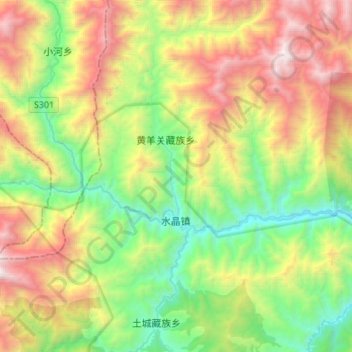
Name: 水晶镇 topographic map, elevation, terrain.
Location: 水晶镇, 平武县, 绵阳市, 四川省, 中国 (32.44397 104.08768 32.60259 104.35894)
Average elevation: 2,112 m
Minimum elevation: 1,026 m
Maximum elevation: 3,948 m
Other topographic maps
Click on a map to view its topography, its elevation and its terrain.