
白马藏族乡 topographic map
Interactive map
Click on the map to display elevation.
About this map
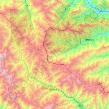
Name: 白马藏族乡 topographic map, elevation, terrain.
Location: 白马藏族乡, 平武县, 绵阳市, 四川省, 中国 (32.67642 103.95008 33.04437 104.39607)
Average elevation: 2,700 m
Minimum elevation: 1,016 m
Maximum elevation: 4,474 m
Other topographic maps
Click on a map to view its topography, its elevation and its terrain.