

Mount Siple topographic map
Click on the map to display elevation.
About this map

Name: Mount Siple topographic map, elevation, terrain.
Location: Mount Siple (-73.42713 -126.78631 -73.42703 -126.78621)
Average elevation: 2,887 m
Minimum elevation: 2,434 m
Maximum elevation: 3,152 m
Other topographic maps
Click on a map to view its topography, its elevation and its terrain.
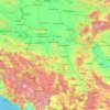
Serbia
Ancient mountains in the southeast corner of the country belong to the Rilo-Rhodope Mountain system. Elevation ranges from the Midžor peak of the Balkan Mountains at 2,169 metres (7,116 feet) (the highest peak in Serbia, excluding Kosovo) to the lowest point of just 17 metres (56 feet) near the Danube river…
Average elevation: 492 m
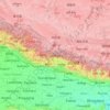
Nepal
Nepal is divided into three principal physiographic belts known as Himal–Pahad–Terai. Himal is the mountain region containing snow and situated in the Great Himalayan Range; it makes up the northern part of Nepal. It contains the highest elevations in the world including 8,848.86 metres (29,032 ft) height…
Average elevation: 2,604 m

Botswana
Botswana (/bɒtˈswɑːnə/ (listen), also UK: /bʊt-, bʊˈtʃw-/), officially the Republic of Botswana (Setswana: Lefatshe la Botswana, [lɪˈfatsʰɪ la bʊˈtswana]), is a landlocked country in Southern Africa. Botswana is topographically flat, with approximately 70 percent of its territory being the…
Average elevation: 1,078 m
Zurich
Switzerland > Zurich > District Zurich
On its west side, the Limmat valley is flanked by the wooded heights of the Albis chain, which runs along the western border. The Uetliberg is, with 869 m (2,851 ft) above sea level, the highest elevation of the surrounding area. Its summit can be reached easily by the Uetlibergbahn. From the platform of the…
Average elevation: 499 m
Gaborone
Gaborone is situated at 24°39′29″S 25°54′44″E / 24.65806°S 25.91222°E / -24.65806; 25.91222 between Kgale and Oodi Hills, on the Notwane River in the south-eastern corner of Botswana, and 15 kilometres (9.3 mi) from the South African border. The city lies at an elevation of 1,010 metres…
Average elevation: 1,032 m
North-East District
Most parts of Botswana have tableland slopes sliding from east to west. It is predominantly savannah, with tall grasses, bushes, and trees. The region has an average elevation of around 915 m (3,002 ft) above sea level. The annual precipitation is around 65 cm (26 in), most of which is received during the…
Average elevation: 1,077 m
Ghanzi District
In the west, Ghanzi borders the Omaheke Region of Namibia. Domestically, it borders the following districts: North-West on the north, Central on the east, Kweneng on the southeast, Kgalagadi on the south. Ghanzi is traversed by the northwesterly line of equal latitude and longitude. This region is largely…
Average elevation: 1,071 m
Kweneng District
Kweneng is the only district without a foreign border. It borders Central District in northeast, Kgatleng District on the east, South-East District in southeast, Southern District in south, Kgalagadi District in the west, Ghanzi District in the north. The region is traversed by the northwesterly line of equal…
Average elevation: 1,083 m
North-West District
The region has an average elevation of around 915 m (3,002 ft) above the mean sea level. The vegetation type is Savannah, with tall grasses, bushes and trees. The annual precipitation is around 650 mm (26 in), most of which is received during the summer season from November to May.
Average elevation: 979 m
Southern District
In the south, Southern borders the North West Province of South Africa. Domestically, it borders South-East District in east, Kweneng District in north, Kgalagadi District and south west. Southern District is traversed by the northwesterly line of equal latitude and longitude. Most part of Botswana has…
Average elevation: 1,139 m
Central District
Most part of Botswana has tableland slopes sliding from east to west. The region has an average elevation of around 915 m (3,002 ft) above the mean sea level. The vegetation type is Savannah, with tall grasses, bushes and trees. The annual precipitation is around 65 cm (26 in), most of which is received during…
Average elevation: 1,006 m




Sheffield
Sheffield nestles on the eastern foothills of the Pennines and is sculpted by a dramatic hill-and-valley system formed where five rivers — the Don, Sheaf, Rivelin, Loxley and Porter — converge, producing steep-sided valleys and gritstone ridgelines with much of the urban area built directly onto hillsides…
Average elevation: 168 m


Saint Croix
United States > United States Virgin Islands > Saint Croix District > Christiansted
Average elevation: 11 m






Yangtze
These tributaries join and the river then runs eastward through Qinghai (Tsinghai), turning southward down a deep valley at the border of Sichuan (Szechwan) and Tibet to reach Yunnan. In the course of this valley, the river's elevation drops from above 5,000 meters (16,000 ft) to less than 1,000 meters (3,300…
Average elevation: 426 m

Vero Beach
United States > Florida > Indian River County
Like much of Florida, Vero Beach is mostly flat, stretching from the beach and running inland. The average elevation of the city is 23 feet above sea level.
Average elevation: 6 m


Spring Hill-City View
United States > Pennsylvania > Allegheny County > Pittsburgh
Average elevation: 292 m
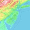
New Jersey
High Point in Montague Township, Sussex County is the state's highest elevation at 1,803 feet (550 m) above sea level. The state's highest prominence is Kitty Ann Mountain in Morris County, rising 892 feet (272 m). The Palisades are a line of steep cliffs on the west side of the Hudson River in Bergen and…
Average elevation: 72 m

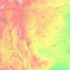
Pecos River
The Pecos River (/ˈpeɪkəs/ PAY-kəs; Spanish: Río Pecos) originates in north-central New Mexico and flows into Texas, emptying into the Rio Grande. Its headwaters are on the eastern slope of the Sangre de Cristo mountain range in Mora County north of Pecos, New Mexico, at an elevation of over 12,000 feet…
Average elevation: 1,271 m


Bronx County
United States > New York > New York
The Bronx's highest elevation at 280 feet (85 m) is in the northwest corner, west of Van Cortlandt Park and in the Chapel Farm area near the Riverdale Country School. The opposite (southeastern) side of the Bronx has four large low peninsulas or "necks" of low-lying land that jut into the waters of the East…
Average elevation: 15 m
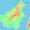
Borneo
Before sea levels rose at the end of the last Ice Age, Borneo was part of the mainland of Asia, forming, with Java and Sumatra, the upland regions of a peninsula that extended east from present day Indochina. The South China Sea and Gulf of Thailand now submerge the former low-lying areas of the peninsula.…
Average elevation: 141 m


New Mexico
New Mexico is a landlocked state in the Southwestern region of the United States. It is one of the Mountain States of the southern Rocky Mountains, sharing the Four Corners region with Utah, Colorado, and Arizona. It also borders the state of Texas to the east and southeast, Oklahoma to the northeast, and…
Average elevation: 1,687 m

Playa Bonita
Spain > Andalusia > Costa del Sol Occidental > La Perla-Torremuelle > Santana
Average elevation: 42 m
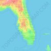
Florida
Florida's topography is characterized by its predominantly flat landscape, with the highest elevation being Britton Hill at just 345 feet (105 meters) above sea level, making it the lowest high point of any U.S. state. The state is primarily divided into three physiographic regions: the Atlantic Coastal Plain,…
Average elevation: 6 m


Novi Becej
Serbia > Central Banat Administrative District > Novi Becej Municipality
Average elevation: 78 m


Bakırköy
While the average elevation is 20-30 meters throughout Bakırköy, this value rises to 70 meters in the north of the district. The ridges slope north-south towards the Marmara Sea. The coastal length of Bakırköy is 13 km, with small cliffs in Yeşilköy and Yeşilyurt neighborhoods and a sandy beach in Florya.
Average elevation: 21 m


Trupale
Serbia > Nisava Administrative District > Градска општина Црвени Крст
Average elevation: 188 m


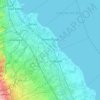

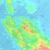
Contra Costa County
In prehistoric times, particularly the Miocene epoch, portions of the landforms now in the area (then marshy and grassy savanna) were populated by a wide range of now extinct mammals, known in modern times by the fossil remains excavated in the southern part of the county. In the northern part of the county,…
Average elevation: 108 m


Northview Heights
United States > Pennsylvania > Allegheny County > Pittsburgh
Average elevation: 328 m


New Cham Suburb
Syria > Damascus Governorate > Damascus Subdistrict > Dummar Municipality
Average elevation: 870 m

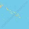
Solomon Islands
The culture of Solomon Islands reflects the extent of the differentiation and diversity among the groups living within the Solomon Islands archipelago, which lies within Melanesia in the Pacific Ocean, with the peoples distinguished by island, language, topography, and geography. The cultural area includes the…
Average elevation: 7 m

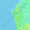

Lipa
At the celebration of the elevation of Lipa to a city in January 1888, José Rizal was invited by Dr. Jose Lozada, Catalino Dimayuga and the brothers Celestino and Simeon Luz but Rizal responded only with his Hymno Al Trabajo which he dedicated to the zeal and industry of the Lipeños.
Average elevation: 208 m

Bangkok
Bangkok is situated in the Chao Phraya River delta in Thailand's central plain. The river meanders through the city in a southerly direction, emptying into the Gulf of Thailand approximately 25 kilometres (16 mi) south of city centre. The area is flat and low-lying, with an average elevation of 1.5 metres (4…
Average elevation: 2 m


South Kivu
Democratic Republic of the Congo
South Kivu's topography varied, with the eastern region dominated by the Mitumba mountain range, which often rises above 3,000 meters in elevation. The central and western parts of the province are marked by high and low plateaus, respectively. The eastern highlands form part of the Albertine Rift, a…
Average elevation: 1,120 m




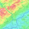
East Falls
United States > Pennsylvania > Philadelphia County > Philadelphia
East Falls takes its name from its location on the east side of the Schuylkill Falls along the Schuylkill River at the original line of waterfalls known as the 'Falls of the Schuylkill' where the river descends from the elevation of the Pennsylvania piedmont to the coastal plain occupied by the main part of…
Average elevation: 54 m

