

Canada topographic maps
Click on a map to view its topography, its elevation and its terrain.
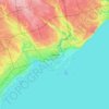
Toronto
Despite its deep ravines, Toronto is not remarkably hilly, but its elevation does increase steadily away from the lake. Elevation differences range from 76.5 metres (251 ft) above sea level at the Lake Ontario shore to 209 m (686 ft) ASL near the York University grounds in the city's north end at the…
Average elevation: 113 m

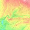
London
Canada > Ontario > London > London
London has a humid continental climate (Köppen Dfb), though due to its downwind location relative to Lake Huron and elevation changes across the city, it is virtually on the Dfa/Dfb (hot summer) boundary favouring the former climate zone to the southwest of the confluence of the South and North Thames Rivers,…
Average elevation: 268 m
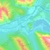
Banff
Canada > Alberta > Banff > Banff
Banff is a town within Banff National Park in Alberta, Canada. It is located in Alberta's Rockies along the Trans-Canada Highway, approximately 126 km (78 mi) west of Calgary and 58 km (36 mi) east of Lake Louise. At 1,400 to 1,630 m (4,590 to 5,350 ft) above sea level, Banff is the community with the second…
Average elevation: 1,615 m
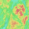
Silent Lake Provincial Park
Canada > Ontario > Haliburton County > Highlands East
Average elevation: 371 m
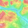
Fredericton
Canada > New Brunswick > Kingsclear Parish > Fredericton
At an altitude of about 17 m (56 ft) above sea level, Fredericton is nestled in the Pennsylvanian Basin. It differs markedly from the geologically older parts of the province. There are prominently two distinct areas in the region that are divided around the area of Wilsey Road, in the east end of the city. In…
Average elevation: 72 m
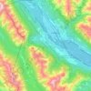


Rock Creek
Canada > British Columbia > Regional District of Kootenay Boundary > Area E (Beaverdell/West Boundary)
Average elevation: 764 m

150 Mile House
Canada > British Columbia > Cariboo Regional District > Area F (Horsefly/Likely/150 Mile House)
Average elevation: 789 m

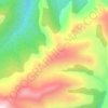

Elkwater
Canada > Alberta > Cypress County
The Elkwater townsite lies at an elevation of about 1,225 m (4,025 ft) on the northwest slope of the Cypress Hills which, with a summit at 1,466 m (4810 ft), are the highest point between the Rocky Mountains and Labrador within Canada. Because of the elevation, the area receives more moisture than the…
Average elevation: 1,294 m
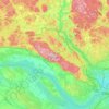


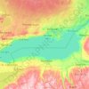
Lake Ontario
Lake Ontario is the easternmost of the Great Lakes and the smallest in surface area (7,340 sq mi, 18,960 km2), although it exceeds Lake Erie in volume (393 cu mi, 1,639 km3). It is the 13th largest lake in the world. When its islands are included, the lake's shoreline is 712 miles (1,146 km) long. As the last…
Average elevation: 214 m
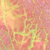
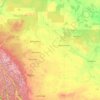


Queens Park
Canada > British Columbia > Metro Vancouver Regional District > New Westminster
Average elevation: 57 m

Athabasca River
The Athabasca River originates in Jasper National Park, in an unnamed lake at the toe of the Columbia Glacier within the Columbia Icefield, between Mount Columbia, Snow Dome, and the Winston Churchill Range, at an elevation of approximately 1,600 metres (5,200 ft). It travels 1,231 km (765 mi) before draining…
Average elevation: 695 m

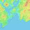

Whitecourt
Canada > Alberta > Whitecourt
Whitecourt is a town in central Alberta, Canada within Woodlands County. It is located approximately 177 km (110 mi) northwest of Edmonton and 279 km (173 mi) southeast of Grande Prairie at the junction of Highway 43 and Highway 32, and has an elevation of 690 m (2,260 ft). The Whitecourt meteor impact crater…
Average elevation: 721 m

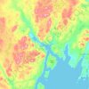

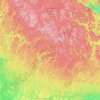

Laurentian Mountains
One of Quebec's official regions is called Laurentides. The mountain range runs through four other regions; Capitale-Nationale, Outaouais, Lanaudière, and Mauricie. The elevation generally ranges from around 500 m (1,640 ft) to 1,000 m (3,280 ft) with Mont Raoul-Blanchard being its highest peak, at 1,166 m…
Average elevation: 348 m



Grande Prairie
Canada > Alberta > Grande Prairie
Grande Prairie is located just north of the 55th parallel north, and is 465 km (289 mi) northwest of Edmonton, lying at an elevation of 669 m (2,195 ft) above sea level. The city is surrounded by farmland to the north, east, and west. To the south lies a vast boreal forest with aspen, tamarack, lodgepole pine,…
Average elevation: 668 m


Lake Huron
Lake Huron (/ˈhjʊərɒn, -ən/ HURE-on, -ən) is one of the five Great Lakes of North America. Hydrologically, it comprises the easterly portion of Lake Michigan–Huron, having the same surface elevation as Lake Michigan, to which it is connected by the 5-mile-wide (8.0 km), 20-fathom-deep (120 ft; 37 m)…
Average elevation: 230 m



Athabasca River
The Athabasca River originates in Jasper National Park, in an unnamed lake at the toe of the Columbia Glacier within the Columbia Icefield, between Mount Columbia, Snow Dome, and the Winston Churchill Range, at an elevation of approximately 1,600 metres (5,200 ft). It travels 1,231 km (765 mi) before draining…
Average elevation: 688 m


Kootenay River
Comparisons of various U.S. Geological Survey (USGS) topographic maps from the 20th century show many misinterpretations or alternative names being applied to the segment of the river within the United States. These include "Kootanie", "Kootenie", and "Kootienay". The Geographic Names Information System of the…
Average elevation: 1,522 m


Stikine River
The extensively glaciated Coast Mountains are the tallest mountains in the Stikine basin, with the highest point being Mount Ratz, 3,136 m (10,289 ft) above sea level. The highest points of the Stikine Plateau are generally around 1,500 to 2,000 m (4,900 to 6,600 ft). The Cassiar and Omineca Mountains, rising…
Average elevation: 1,223 m


Coppermine River
The river is on the northwestern part of the Canadian Shield. It was covered by the Laurentide ice sheet which melted away 10,000 years ago. Above and below Bloody Falls, the river width is broad due to fluvioglacial erosion. At the falls, the river is described to be narrow and fast-moving rapid with the…
Average elevation: 391 m


Attawapiskat River
The source of the river is Attawapiskat Lake at an elevation of 241 metres (791 ft). The main rivers flowing into the lake that are thus part of the Attawapiskat River drainage basin are the Marten-Drinking River, the Otoskwin River and the Pineimuta River.
Average elevation: 139 m
