
阳朔县 topographic map
Interactive map
Click on the map to display elevation.
About this map
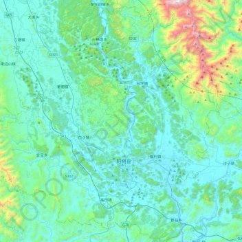
Name: 阳朔县 topographic map, elevation, terrain.
Location: 阳朔县, 桂林市, 广西壮族自治区, 中国 (24.63691 110.22279 25.06661 110.67843)
Average elevation: 319 m
Minimum elevation: 93 m
Maximum elevation: 1,659 m
最高峰为东北部海洋山的嵩坪龙,海拔1701米。
Other topographic maps
Click on a map to view its topography, its elevation and its terrain.