
象山区 topographic map
Interactive map
Click on the map to display elevation.
About this map
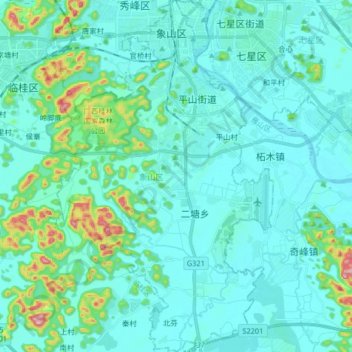
Name: 象山区 topographic map, elevation, terrain.
Location: 象山区, 桂林市, 广西壮族自治区, 中国 (25.13032 110.22333 25.27816 110.32383)
Average elevation: 179 m
Minimum elevation: 135 m
Maximum elevation: 457 m
Other topographic maps
Click on a map to view its topography, its elevation and its terrain.