
相公山 topographic map
Interactive map
Click on the map to display elevation.
About this map
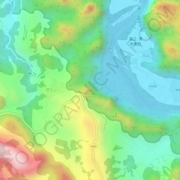
Name: 相公山 topographic map, elevation, terrain.
Location: 相公山, 桂林市, 广西壮族自治区, 541906, 中国 (24.92578 110.47899 24.92588 110.47909)
Average elevation: 261 m
Minimum elevation: 113 m
Maximum elevation: 540 m
Other topographic maps
Click on a map to view its topography, its elevation and its terrain.