
灌阳县 topographic map
Interactive map
Click on the map to display elevation.
About this map
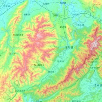
Name: 灌阳县 topographic map, elevation, terrain.
Location: 灌阳县, 桂林市, 广西壮族自治区, 541607, 中国 (25.18090 110.72152 25.75884 111.33813)
Average elevation: 635 m
Minimum elevation: 174 m
Maximum elevation: 1,955 m
Other topographic maps
Click on a map to view its topography, its elevation and its terrain.