
恭城县 topographic map
Interactive map
Click on the map to display elevation.
About this map
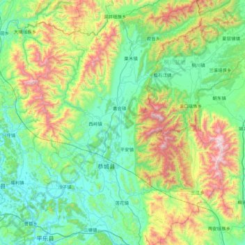
Name: 恭城县 topographic map, elevation, terrain.
Location: 恭城县, 桂林市, 广西壮族自治区, 中国 (24.61625 110.61154 25.28819 111.17195)
Average elevation: 509 m
Minimum elevation: 91 m
Maximum elevation: 1,807 m
县境大致为三面环山,西南开口的盆地,北为都庞岭,西为海洋山,东为花山,最高峰为花山的银锭山,海拔1885米。西南部有喀斯特地貌分布。
Other topographic maps
Click on a map to view its topography, its elevation and its terrain.