
尖扎县 topographic map
Interactive map
Click on the map to display elevation.
About this map
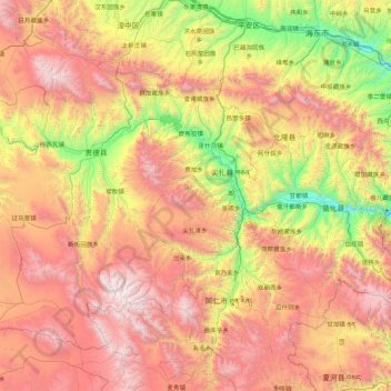
Name: 尖扎县 topographic map, elevation, terrain.
Location: 尖扎县, 黄南藏族自治州, 青海省, 中国 (35.18554 101.17040 36.58554 102.57040)
Average elevation: 3,159 m
Minimum elevation: 1,836 m
Maximum elevation: 4,938 m
Other topographic maps
Click on a map to view its topography, its elevation and its terrain.