
丹麻镇 topographic map
Interactive map
Click on the map to display elevation.
About this map
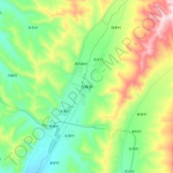
Name: 丹麻镇 topographic map, elevation, terrain.
Location: 丹麻镇, 互助土族自治县, 海东市, 青海省, 中国 (36.76182 102.07187 36.84182 102.15187)
Average elevation: 2,805 m
Minimum elevation: 2,598 m
Maximum elevation: 3,156 m
Other topographic maps
Click on a map to view its topography, its elevation and its terrain.