
韭菜沟村 topographic map
Interactive map
Click on the map to display elevation.
About this map
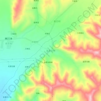
Name: 韭菜沟村 topographic map, elevation, terrain.
Location: 韭菜沟村, 林川乡, 互助土族自治县, 海东市, 青海省, 中国 (36.90082 101.98835 36.94082 102.02835)
Average elevation: 2,755 m
Minimum elevation: 2,636 m
Maximum elevation: 2,910 m