
八一路街道 topographic map
Interactive map
Click on the map to display elevation.
About this map
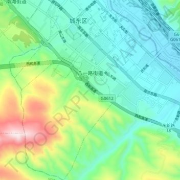
Name: 八一路街道 topographic map, elevation, terrain.
Location: 八一路街道, 城东区, 西宁市, 青海省, 810000, 中国 (36.54861 101.77928 36.60649 101.83365)
Average elevation: 2,353 m
Minimum elevation: 2,193 m
Maximum elevation: 2,786 m