
上关村 topographic map
Interactive map
Click on the map to display elevation.
About this map
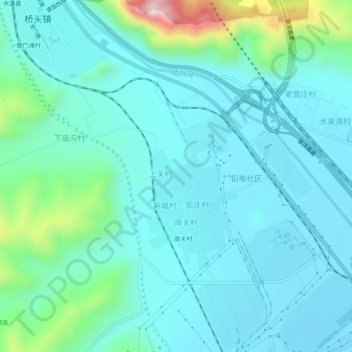
Name: 上关村 topographic map, elevation, terrain.
Location: 上关村, 大通回族土族自治县, 西宁市, 青海省, 810100, 中国 (36.88973 101.68139 36.92973 101.72139)
Average elevation: 2,492 m
Minimum elevation: 2,406 m
Maximum elevation: 2,918 m