
Make a donation
New Zealand topographic map
Click on the map to display elevation.
Make a donation
New Zealand
New Zealand is an island country in the southwestern Pacific Ocean. It consists of two main landmasses—the North Island (Te Ika-a-Māui) and the South Island (Te Waipounamu)—and over 700 smaller islands. It is the sixth-largest island country by area and lies east of Australia across the Tasman Sea and south of the islands of New Caledonia, Fiji, and Tonga. The country's varied topography and sharp mountain peaks, including the Southern Alps, owe much to tectonic uplift and volcanic eruptions. New Zealand's capital city is Wellington, and its most populous city is Auckland.
Make a donation
About this map
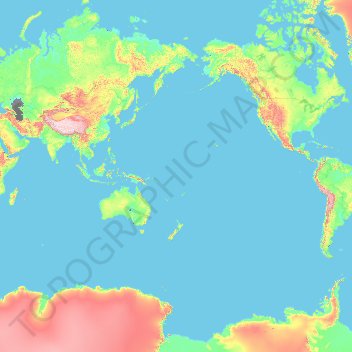
Name: New Zealand topographic map, elevation, terrain.
Location: New Zealand (-52.82137 -179.05915 -29.03033 179.36436)
Average elevation: 399 m
Minimum elevation: -30 m
Maximum elevation: 6,245 m
Make a donation
Other topographic maps
Click on a map to view its topography, its elevation and its terrain.
Gaborone
Botswana > South-East District
Gaborone is situated at 24°39′29″S 25°54′44″E / 24.65806°S 25.91222°E / -24.65806; 25.91222 between Kgale and Oodi Hills, on the Notwane River in the south-eastern corner of Botswana, and 15 kilometres (9.3 mi) from the South African border The city lies at an elevation of 1,010 metres…
Average elevation: 1,032 m
KwaMhlanga
South Africa > Mpumalanga > Nkangala > Thembisile Hani Local Municipality
Average elevation: 1,338 m
Make a donation
Вранићки Тарајиш
Serbia > City of Belgrade > Barajevo Urban Municipality > Vranic
Average elevation: 162 m
Make a donation
Make a donation
Maunatlala
As time passed by Kgosi Mapena’s eldest son who was named Maunatlala died, the village’ name was changed from Kopung to Maunatlala. Climatic Conditions The climate of Maunatlala area is semi-arid with dry winters and fairly wet summer months, with drought endemic. The average precipitation for the area is…
Average elevation: 878 m
Make a donation
Make a donation
Dandenong Ranges
Australia > Victoria > Melbourne
The topography consists of a series of ridges dissected by deeply cut streams. Sheltered gullies in the south of the range are home to temperate rain forest, fern gullies and mountain ash forest Eucalyptus regnans, whereas the drier ridges and exposed northern slopes are covered by dry sclerophyll forest of…
Average elevation: 456 m
Make a donation
Wellington
South Africa > Western Cape > Cape Winelands District Municipality > Drakenstein Local Municipality
Average elevation: 168 m
Nahoon River
South Africa > Eastern Cape > Buffalo City Metropolitan Municipality > KuGompo City
Average elevation: 65 m
Make a donation
Mamelodi
South Africa > Gauteng > City of Tshwane Metropolitan Municipality
Average elevation: 1,319 m
Overlooking the steppe and sand dunes
Mongolia > Ömnögovi > Sevrey > Sevrey
Average elevation: 1,796 m
Mutale
South Africa > Limpopo > Vhembe District Municipality > Mutale Local Municipality
Average elevation: 755 m
Make a donation
Serule
Botswana > Central District > Serule
The population according to the 2001 census was 2,268 and it is estimated at more than 3000 in the latest 2011 census. The people of Serule Village comprises different ethnicities namely Bangwato, Bakwena, Batalaote, Bakalanga, Bahurutshe and its six wards are Mothoathubega, Borotsi, Mokwena, Botalaote,…
Average elevation: 935 m
Make a donation
Ghorahi
Nepal > Lumbini Province > Dang
Ghorahi is the main town of the Rapti Zone and also the headquarters of the Dang district. It is located at an elevation of 2,300 feet (700 m) in the Mahabharat-Chure hill region.
Average elevation: 865 m
Kigali
Rwanda > Kigali City > Nyarugenge District
Kigali is located in the centre of Rwanda, at 1°57′S 30°4′E. Like the rest of Rwanda it uses Central Africa Time, and is two hours ahead of Coordinated Universal Time (UTC+02:00) throughout the year. The city is coterminous with the province of Kigali, one of the five provinces of Rwanda introduced in…
Average elevation: 1,530 m
Make a donation
Make a donation
KuGompo City
South Africa > Eastern Cape > Buffalo City Metropolitan Municipality
Average elevation: 72 m
Make a donation
Toubkal
Morocco > cercle d'Asni > Asni
Toubkal, also Jbel Toubkal or Jebel Toubkal, is a mountain in southwestern Morocco, located in the Toubkal National Park. At 4,167 m (13,671 ft), it is the highest peak in Morocco, the Atlas Mountains, North Africa and the Arab world. Located 63 km (39 mi) south of the city of Marrakesh, and visible from it,…
Average elevation: 3,616 m
Graskop
South Africa > Mpumalanga > Ehlanzeni District Municipality > Thaba Chweu Local Municipality
Average elevation: 1,385 m
Phiphidi Waterfall
South Africa > Limpopo > Vhembe District Municipality > Thulamela Local Municipality
Average elevation: 781 m
Make a donation
Ghazni
Ghazni's climate is transitional between a cold semi-arid climate (Köppen climate classification BSk) and a hot-summer humid continental climate (Dsa). It has cold, snowy winters and warm, dry summers. Precipitation is low and mostly falls in winter (as snow) and spring (as rain). Winters are very cold, with…
Average elevation: 2,341 m
Make a donation
Make a donation
Karpenisi
Greece > Central Greece > Regional Unit of Evrytania > Municipal Unit of Karpenisi
Karpenisi (Greek: Καρπενήσι, Greek pronunciation: [karpeˈnisi]) is a town in central Greece. It is the capital of the regional unit of Evrytania. Karpenisi lies within the valley of the river Karpenisiotis (Καρπενησιώτης), a tributary of the Megdovas, in the southern part of the Pindus…
Average elevation: 1,236 m
Make a donation
Make a donation
Reykjahlíð
Reykjahlíð (Icelandic pronunciation: [ˈreiːcaˌl̥iːθ]) is a village situated on the shores of Lake Mývatn in the north of Iceland. It is the seat of the municipality of Þingeyjarsveit. It has 227 inhabitants as of 2021. With an elevation of 292 meters above sea level it ranks as the highest situated…
Average elevation: 305 m
Nilambur
The 2,554 m (8,379 ft) m high Mukurthi peak, which is situated in the border of Nilambur Taluk and Ooty Taluk, and is also the fifth-highest peak in South India as well as the third-highest in Kerala after Anamudi (2,696 m [8,845 ft]) and Meesapulimala (2,651 m [8,698 ft]), is the highest point of elevation in…
Average elevation: 33 m
Make a donation
Heilbron
South Africa > Free State > Fezile Dabi District Municipality > Ngwathe Local Municipality
Average elevation: 1,559 m
Bela-Bela
South Africa > Limpopo > Waterberg District Municipality > Bela Bela Local Municipality
Average elevation: 1,158 m
Make a donation
Demebecha
Dembecha is a town in northwestern Ethiopia 349 km north of Addis Ababa. Located in the Mirab Gojjam Zone of the Amhara Region, this town has a latitude and longitude of 10°33′N 37°29′E / 10.550°N 37.483°E / 10.550; 37.483 with an elevation of 2083 meters above sea level. It is one of three…
Average elevation: 2,125 m
Loutraki
Greece > Peloponnese, Western Greece and the Ionian > Corinthia Regional Unit > Municipal Unit of Loutraki - Perachora
Average elevation: 225 m
Robertson
South Africa > Western Cape > Cape Winelands District Municipality > Langeberg Local Municipality
Average elevation: 249 m
Make a donation
Make a donation
Pongola
South Africa > KwaZulu-Natal > Zululand District Municipality > uPhongolo Local Municipality > Pongola
Average elevation: 291 m
Make a donation
Welkom
South Africa > Free State > Lejweleputswa District Municipality
Koppie Alleen is the only hill near Welkom and therefore is aptly named for its oddity. The terrain elevation above sea level is 1435 metres. The largest water catchment is the Sand River to the south-east of Welkom in Virginia's direction. Large saline pans such as Flamingo Pan and Theronia Pan are situated…
Average elevation: 1,341 m
Make a donation
Manila
Almost all of Manila sits on top of centuries of prehistoric alluvial deposits built by the waters of the Pasig River and on some land reclaimed from Manila Bay. Manila's land has been altered substantially by human intervention, with considerable land reclamation along the waterfronts since the American…
Average elevation: 13 m
Mediterranean Sea
Average elevation: 0 m
Make a donation
Make a donation