
黄圃镇 topographic map
Interactive map
Click on the map to display elevation.
About this map
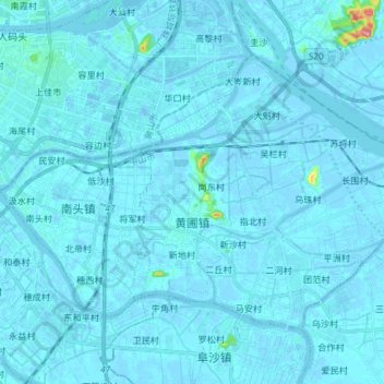
Name: 黄圃镇 topographic map, elevation, terrain.
Location: 黄圃镇, 中山市, 广东省, 中国 (22.67841 113.31492 22.77612 113.46271)
Average elevation: 3 m
Minimum elevation: -11 m
Maximum elevation: 114 m
Other topographic maps
Click on a map to view its topography, its elevation and its terrain.