
凉城县 topographic map
Interactive map
Click on the map to display elevation.
About this map
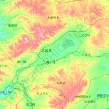
Name: 凉城县 topographic map, elevation, terrain.
Location: 凉城县, 乌兰察布市, 内蒙古自治区, 中国 (40.16215 112.03823 40.84370 113.02291)
Average elevation: 1,480 m
Minimum elevation: 1,143 m
Maximum elevation: 2,292 m
Other topographic maps
Click on a map to view its topography, its elevation and its terrain.