
乌兰花镇 topographic map
Interactive map
Click on the map to display elevation.
About this map
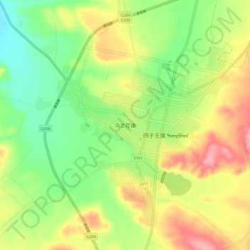
Name: 乌兰花镇 topographic map, elevation, terrain.
Location: 乌兰花镇, 乌兰察布市, 内蒙古自治区, 中国 (41.48909 111.64408 41.56909 111.72408)
Average elevation: 1,495 m
Minimum elevation: 1,448 m
Maximum elevation: 1,553 m
Other topographic maps
Click on a map to view its topography, its elevation and its terrain.