
黄旗海 topographic map
Interactive map
Click on the map to display elevation.
About this map
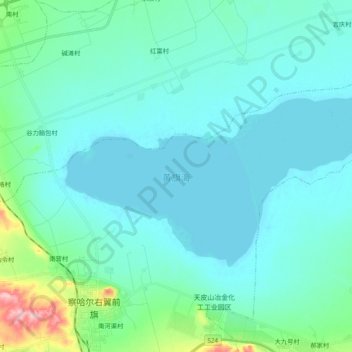
Name: 黄旗海 topographic map, elevation, terrain.
Location: 黄旗海, 乌兰察布市, 内蒙古自治区, 中国 (40.80125 113.19168 40.87645 113.38411)
Average elevation: 1,283 m
Minimum elevation: 1,261 m
Maximum elevation: 1,420 m
Other topographic maps
Click on a map to view its topography, its elevation and its terrain.