
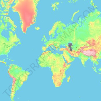
Norway topographic map
Interactive map
Click on the map to display elevation.
About this map
Name: Norway topographic map, elevation, terrain.
Location: Norway (-54.65400 -9.68463 81.02802 34.68891)
Average elevation: 294 m
Minimum elevation: -30 m
Maximum elevation: 7,179 m
Little has been found dating from the early Iron Age (the last 500 years BC). The dead were cremated, and their graves contain few burial goods. During the first four centuries AD, the people of Norway were in contact with Roman-occupied Gaul. About 70 Roman bronze cauldrons, often used as burial urns, have been found. Contact with the civilised countries farther south brought a knowledge of runes; the oldest known Norwegian runic inscription dates from the third century. At this time, the amount of settled area in the country increased, a development that can be traced by coordinated studies of topography, archaeology, and place-names. The oldest root names, such as nes, vik, and bø ("cape," "bay," and "farm"), are of great antiquity, dating perhaps from the Bronze Age, whereas the earliest of the groups of compound names with the suffixes vin ("meadow") or heim ("settlement"), as in Bjǫrgvin (Bergen) or Sǿheim (Seim), usually date from the first century AD.
Other topographic maps
Click on a map to view its topography, its elevation and its terrain.
Serbia
Serbia
Average elevation: 492 m
Ocheretyne
Ocheretyne, Ocheretyne settlement hromada, Pokrovskii Raion, Donetsk Oblast, 86020, Ukraine
Average elevation: 227 m
Nepal
Nepal
Average elevation: 2,604 m
West Bretton
United Kingdom > England > Wakefield
West Bretton, Wakefield, West Yorkshire, England, United Kingdom
Average elevation: 109 m
19250
France > Nouvelle-Aquitaine > Corrèze > Ambrugeat > Le Montbazet
19250, Le Montbazet, Ambrugeat, Ussel, Corrèze, Nouvelle-Aquitaine, Metropolitan France, France
Average elevation: 681 m
Auckland
Auckland, Waitematā, Auckland, 1010, New Zealand
Average elevation: 32 m
General Santos
Philippines > South Cotabato > General Santos
General Santos, South Cotabato, Soccsksargen, 9500, Philippines
Average elevation: 149 m
Laguna del Carbón
Argentina > Santa Cruz Province
Laguna del Carbón, Corpen Aike, Santa Cruz Province, Argentina
Average elevation: -102 m
Nonconnah Creek
United States > Tennessee > Shelby County > Memphis
Nonconnah Creek, Memphis, Shelby County, West Tennessee, Tennessee, United States
Average elevation: 96 m
Crawford
United Kingdom > Scotland > South Lanarkshire
Crawford, South Lanarkshire, Scotland, ML12 6TP, United Kingdom
Average elevation: 314 m
Bergen aan Zee
Bergen aan Zee, Bergen, North Holland, Netherlands
Average elevation: 6 m
Stari Ledinci
Serbia > Vojvodina > South Backa Administrative District
Stari Ledinci, City of Novi Sad, South Backa Administrative District, Vojvodina, 21206, Serbia
Average elevation: 255 m
Iku Tol
Nepal > Bagmati Province > Bhaktapur > Changunarayan
Iku Tol, Changunarayan-04, Changunarayan, Changunarayan Municipality, Bhaktapur, Bagmati Province, 44603, Nepal
Average elevation: 1,372 m
Barcelona
Spain > Catalonia > Barcelonès
Barcelona, Barcelonès, Barcelona, Catalonia, 08001, Spain
Average elevation: 65 m
Despotovac
Serbia > Central Serbia > Pomoravlje Administrative District > Despotovac Municipality
Despotovac, Despotovac Municipality, Pomoravlje Administrative District, Central Serbia, 35213, Serbia
Average elevation: 259 m
Sonthofen
Germany > Bavaria > Landkreis Oberallgäu
Sonthofen, Landkreis Oberallgäu, Bavaria, 87527, Germany
Average elevation: 964 m
Ascona
Switzerland > Ticino > Distretto di Locarno
Ascona, Circolo dell'Isole, Distretto di Locarno, Ticino, 6612, Switzerland
Average elevation: 329 m
Khudumelapye
Khudumelapye, Kweneng District, Botswana
Average elevation: 1,071 m
Vlaska
Serbia > Central Serbia > City of Belgrade > Mladenovac Urban Municipality
Vlaska, Mladenovac Urban Municipality, City of Belgrade, Central Serbia, Serbia
Average elevation: 225 m
Ramotswa
Botswana > South-East District
Ramotswa, South-East District, Botswana
Average elevation: 1,043 m
Rabrovac
Serbia > Central Serbia > City of Belgrade > Mladenovac Urban Municipality
Rabrovac, Mladenovac Urban Municipality, City of Belgrade, Central Serbia, Serbia
Average elevation: 160 m
Cherokee County
Cherokee County, Georgia, United States
Average elevation: 332 m
Village of East Hampton
United States > New York > Suffolk County > Town of East Hampton
Village of East Hampton, Town of East Hampton, Suffolk County, New York, United States
Average elevation: 7 m
Marina
United States > California > Monterey County
Marina, Monterey County, California, 93933, United States
Average elevation: 17 m
Penarth
United Kingdom > Wales > Vale of Glamorgan
Penarth, Vale of Glamorgan, Wales, United Kingdom
Average elevation: 17 m
Mladenovac Urban Municipality
Serbia > Central Serbia > City of Belgrade
Mladenovac Urban Municipality, City of Belgrade, Central Serbia, Serbia
Average elevation: 211 m
Boljevci
Serbia > Central Serbia > City of Belgrade > Surcin Urban Municipality
Boljevci, Surcin Urban Municipality, City of Belgrade, Central Serbia, 11275, Serbia
Average elevation: 76 m
Murcia
Spain > Área Metropolitana de Murcia
Murcia, Área Metropolitana de Murcia, Spain
Average elevation: 171 m
Avdiivka
Avdiivka, Avdiivka urban hromada, Pokrovskii Raion, Donetsk Oblast, 86060-86075, Ukraine
Average elevation: 206 m
Agalatovo
Russia > Leningrad oblast > Vsevolozhsky District
Agalatovo, Агалатовское сельское поселение, Vsevolozhsky District, Leningrad oblast, Northwestern Federal District, 188653, Russia
Average elevation: 88 m
Morro Bay
United States > California > San Luis Obispo County
Morro Bay, San Luis Obispo County, California, 93442, United States
Average elevation: 54 m
Khandbari
Nepal > Koshi Province > Sankhuwasabha
Khandbari, Sankhuwasabha, Koshi Province, Nepal
Average elevation: 857 m
Nikiti
Greece > Macedonia and Thrace > Chalkidiki Regional Unit > Sithonia Municipal Unit
Nikiti, Sithonia Municipal Unit, Municipality of Sithonia, Chalkidiki Regional Unit, Central Macedonia, Macedonia and Thrace, 630 88, Greece
Average elevation: 64 m
Sauraha Chok
Nepal > Bagmati Province > Chitwan > Ratnanagar
Sauraha Chok, Ratnanagar-01, Ratnanagar, Chitwan, Bagmati Province, 44204, Nepal
Average elevation: 197 m
Glamang
Philippines > South Cotabato > Polomolok
Glamang, Polomolok, South Cotabato, Soccsksargen, 9504, Philippines
Average elevation: 223 m
Barajevo
Serbia > Central Serbia > City of Belgrade > Barajevo Urban Municipality
Barajevo, Barajevo Urban Municipality, City of Belgrade, Central Serbia, 11460, Serbia
Average elevation: 175 m
Koracica
Serbia > Central Serbia > City of Belgrade > Mladenovac Urban Municipality
Koracica, Mladenovac Urban Municipality, City of Belgrade, Central Serbia, Serbia
Average elevation: 251 m
Jagnjilo
Serbia > Central Serbia > City of Belgrade > Mladenovac Urban Municipality
Jagnjilo, Mladenovac Urban Municipality, City of Belgrade, Central Serbia, Serbia
Average elevation: 155 m
Icaria
Greece > Aegean > Ikaria Regional Unit
Icaria, Ikaria Regional Unit, Northern Aegean, Aegean, Greece
Average elevation: 87 m
Ilayang Dupay
Ilayang Dupay, Lucena, 2nd District, Calabarzon, 4301, Philippines
Average elevation: 53 m
Novi Slankamen
Serbia > Vojvodina > Srem Administrative District > Indjija Municipality
Novi Slankamen, Indjija Municipality, Srem Administrative District, Vojvodina, 22323, Serbia
Average elevation: 130 m