
和平县 topographic map
Interactive map
Click on the map to display elevation.
About this map
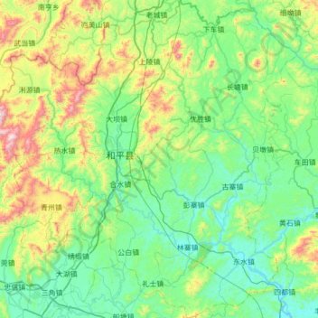
Name: 和平县 topographic map, elevation, terrain.
Location: 和平县, 河源市, 广东省, 中国 (24.16246 114.68733 24.71267 115.27074)
Average elevation: 309 m
Minimum elevation: 67 m
Maximum elevation: 1,157 m
Other topographic maps
Click on a map to view its topography, its elevation and its terrain.