
团街镇 topographic map
Interactive map
Click on the map to display elevation.
About this map
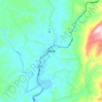
Name: 团街镇 topographic map, elevation, terrain.
Location: 团街镇, 昆明市, 云南省, 中国 (25.72518 102.48692 25.80518 102.56692)
Average elevation: 1,965 m
Minimum elevation: 1,782 m
Maximum elevation: 2,697 m
Other topographic maps
Click on a map to view its topography, its elevation and its terrain.