
湟中区 topographic map
Interactive map
Click on the map to display elevation.
About this map
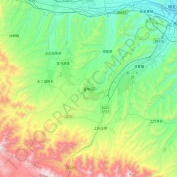
Name: 湟中区 topographic map, elevation, terrain.
Location: 湟中区, 西宁市, 青海省, 中国 (36.33977 101.41190 36.65977 101.73190)
Average elevation: 2,815 m
Minimum elevation: 2,230 m
Maximum elevation: 4,188 m
湟中区,轄區內有著名的名胜古迹有塔尔寺。海拔2225-4488米。
Other topographic maps
Click on a map to view its topography, its elevation and its terrain.