
扎麻隆村 topographic map
Interactive map
Click on the map to display elevation.
About this map
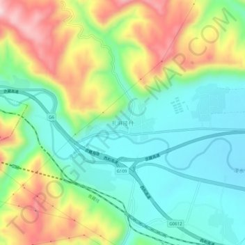
Name: 扎麻隆村 topographic map, elevation, terrain.
Location: 扎麻隆村, 湟中区, 西宁市, 青海省, 中国 (36.64444 101.42482 36.68444 101.46482)
Average elevation: 2,535 m
Minimum elevation: 2,404 m
Maximum elevation: 2,770 m
Other topographic maps
Click on a map to view its topography, its elevation and its terrain.