
清涧县 topographic map
Interactive map
Click on the map to display elevation.
About this map
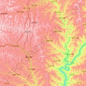
Name: 清涧县 topographic map, elevation, terrain.
Location: 清涧县, 榆林市, 陕西省, 中国 (36.94386 109.95264 37.42045 110.64933)
Average elevation: 979 m
Minimum elevation: 550 m
Maximum elevation: 1,277 m
隔黄河与山西石楼县相望,毗邻子长、子洲、延川、绥德。东西长95公里,南北宽55公里。清涧是贫困县,境内典型黄土高原沟壑纵横的地形,气候干旱且水土流失严重。缺乏矿产资源。
Other topographic maps
Click on a map to view its topography, its elevation and its terrain.