
定边县 topographic map
Interactive map
Click on the map to display elevation.
About this map
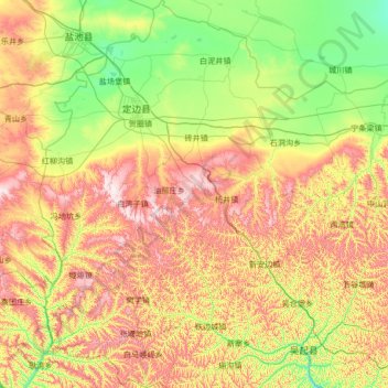
Name: 定边县 topographic map, elevation, terrain.
Location: 定边县, 榆林市, 陕西省, 中国 (36.81537 107.25112 37.88824 108.37898)
Average elevation: 1,497 m
Minimum elevation: 1,267 m
Maximum elevation: 1,911 m
Other topographic maps
Click on a map to view its topography, its elevation and its terrain.