
北尖岛 topographic map
Interactive map
Click on the map to display elevation.
About this map
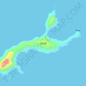
Name: 北尖岛 topographic map, elevation, terrain.
Location: 北尖岛, 珠海万山海洋开发试验区, 香洲区, 珠海市, 广东省, 中国 (21.88352 114.03008 21.91363 114.07175)
Average elevation: 11 m
Minimum elevation: -1 m
Maximum elevation: 274 m
Other topographic maps
Click on a map to view its topography, its elevation and its terrain.