
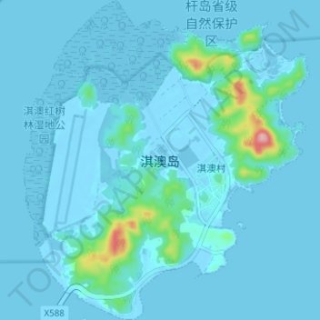
淇澳岛 topographic map
Interactive map
Click on the map to display elevation.
About this map
Name: 淇澳岛 topographic map, elevation, terrain.
Location: 淇澳岛, 香洲区, 珠海市, 广东省, 519000, 中国 (22.38746 113.60524 22.44512 113.66121)
Average elevation: 11 m
Minimum elevation: -8 m
Maximum elevation: 159 m
Other topographic maps
Click on a map to view its topography, its elevation and its terrain.