
直湾岛 topographic map
Interactive map
Click on the map to display elevation.
About this map
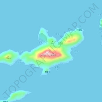
Name: 直湾岛 topographic map, elevation, terrain.
Location: 直湾岛, 香洲区, 珠海市, 广东省, 中国 (21.98041 114.11910 22.00163 114.16828)
Average elevation: 19 m
Minimum elevation: 0 m
Maximum elevation: 356 m
Other topographic maps
Click on a map to view its topography, its elevation and its terrain.