
满江街道 topographic map
Interactive map
Click on the map to display elevation.
About this map
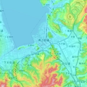
Name: 满江街道 topographic map, elevation, terrain.
Location: 满江街道, 大理市, 大理白族自治州, 云南省, 中国 (25.55036 100.23597 25.67320 100.34350)
Average elevation: 2,043 m
Minimum elevation: 1,961 m
Maximum elevation: 2,454 m
Other topographic maps
Click on a map to view its topography, its elevation and its terrain.