
凤仪镇 topographic map
Interactive map
Click on the map to display elevation.
About this map
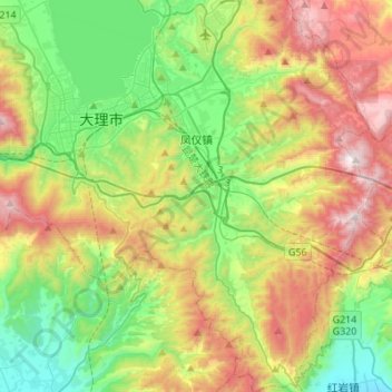
Name: 凤仪镇 topographic map, elevation, terrain.
Location: 凤仪镇, 大理市, 大理白族自治州, 云南省, 中国 (25.42414 100.27171 25.67098 100.43644)
Average elevation: 2,241 m
Minimum elevation: 1,723 m
Maximum elevation: 3,109 m
Other topographic maps
Click on a map to view its topography, its elevation and its terrain.