
洱海 topographic map
Interactive map
Click on the map to display elevation.
About this map
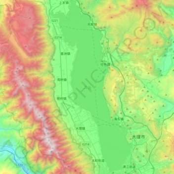
Name: 洱海 topographic map, elevation, terrain.
Location: 洱海, 大理市, 大理白族自治州, 云南省, 中国 (25.60118 100.09601 25.96465 100.28784)
Average elevation: 2,386 m
Minimum elevation: 1,488 m
Maximum elevation: 4,076 m
Other topographic maps
Click on a map to view its topography, its elevation and its terrain.