
镇坪县 topographic map
Interactive map
Click on the map to display elevation.
About this map
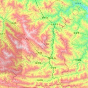
Name: 镇坪县 topographic map, elevation, terrain.
Location: 镇坪县, 安康市, 陕西省, 中国 (31.70667 109.18676 32.22717 109.63650)
Average elevation: 1,501 m
Minimum elevation: 408 m
Maximum elevation: 2,884 m
Other topographic maps
Click on a map to view its topography, its elevation and its terrain.