
岚皋县 topographic map
Interactive map
Click on the map to display elevation.
About this map
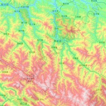
Name: 岚皋县 topographic map, elevation, terrain.
Location: 岚皋县, 安康市, 陕西省, 中国 (31.93464 108.62448 32.54885 109.17439)
Average elevation: 1,220 m
Minimum elevation: 316 m
Maximum elevation: 2,623 m
Other topographic maps
Click on a map to view its topography, its elevation and its terrain.