
汉滨区 topographic map
Interactive map
Click on the map to display elevation.
About this map
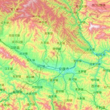
Name: 汉滨区 topographic map, elevation, terrain.
Location: 汉滨区, 安康市, 陕西省, 中国 (32.36938 108.50392 33.28555 109.38483)
Average elevation: 814 m
Minimum elevation: 210 m
Maximum elevation: 2,278 m
Other topographic maps
Click on a map to view its topography, its elevation and its terrain.