
外鸡笼山 topographic map
Interactive map
Click on the map to display elevation.
About this map
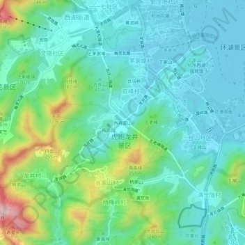
Name: 外鸡笼山 topographic map, elevation, terrain.
Location: 外鸡笼山, 西湖街道, 西湖区, 杭州市, 浙江省, 310013, 中国 (30.21045 120.09518 30.25045 120.13518)
Average elevation: 86 m
Minimum elevation: 7 m
Maximum elevation: 336 m
Other topographic maps
Click on a map to view its topography, its elevation and its terrain.