
扎鲁特旗 topographic map
Interactive map
Click on the map to display elevation.
About this map
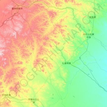
Name: 扎鲁特旗 topographic map, elevation, terrain.
Location: 扎鲁特旗, 通辽市, 内蒙古自治区, 中国 (43.83726 119.23521 45.59258 121.93758)
Average elevation: 526 m
Minimum elevation: 178 m
Maximum elevation: 1,584 m
Other topographic maps
Click on a map to view its topography, its elevation and its terrain.