
花吐古拉镇 topographic map
Interactive map
Click on the map to display elevation.
About this map
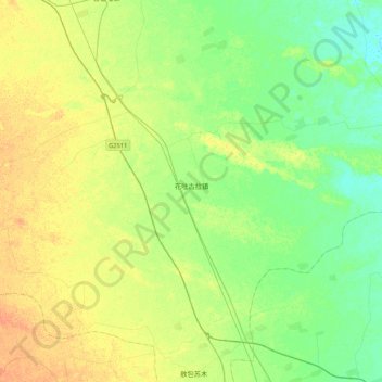
Name: 花吐古拉镇 topographic map, elevation, terrain.
Location: 花吐古拉镇, 科左中;科尔沁左翼中旗;Ke'erqin Zuoyi Zhongqi, 通辽市, 内蒙古自治区, 中国 (43.78627 121.85509 43.96891 122.27981)
Average elevation: 184 m
Minimum elevation: 170 m
Maximum elevation: 202 m