
五山街道 topographic map
Interactive map
Click on the map to display elevation.
About this map
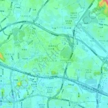
Name: 五山街道 topographic map, elevation, terrain.
Location: 五山街道, 天河区, 广州市, 广东省, 中国 (23.14382 113.32158 23.17242 113.37621)
Average elevation: 26 m
Minimum elevation: -2 m
Maximum elevation: 138 m
Other topographic maps
Click on a map to view its topography, its elevation and its terrain.