
Halti topographic map
Interactive map
Click on the map to display elevation.
Halti
Halti (Finnish: Halti, rarely Haltiatunturi, Northern Sami: Háldičohkka, Swedish: Halde fjäll) is a fell at the border between Norway and Finland. The peak (elevation 1,365 m (4,478 ft)) of the fell, called Ráisduattarháldi, is in Norway, on the border between the municipalities of Nordreisa and Gáivuotna–Kåfjord, about 1 kilometre (0.62 mi) north of the border with Finland. The highest point of the fell on the Finnish side is at 1,324 m (4,344 ft) above sea level, and thus the highest point in the country. The Finnish side of Halti belongs to the municipality of Enontekiö in the province of Lapland.
About this map
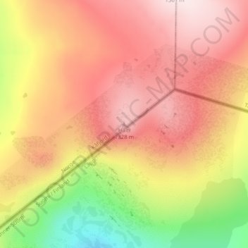
Name: Halti topographic map, elevation, terrain.
Location: Halti, Kåfjord, Troms og Finnmark, Norway (69.30801 21.26327 69.30811 21.26337)
Average elevation: 1,192 m
Minimum elevation: 950 m
Maximum elevation: 1,358 m
Other topographic maps
Click on a map to view its topography, its elevation and its terrain.
Nordland
In the geological past, a collision with Greenland pushed long slices of the seabed on top of the existing bedrock, today forming the bedrock from Dovrefjell and Trollheimen south of Trondheim stretching north in Trøndelag and through Nordland to justh north of Tromsø. This Cambrian—Silurian bedrock, much…
Average elevation: 259 m
Jan Mayen
Jan Mayen consists of two geographically distinct parts. Nord-Jan has a round shape and is dominated by the 2,277 m (7,470 ft) high Beerenberg volcano with its large ice cap (114.2 km2 or 44 sq mi), which can be divided into twenty individual outlet glaciers. The largest of those is Sørbreen, with an area of…
Average elevation: 23 m