
Bergen topographic map
Interactive map
Click on the map to display elevation.
About this map
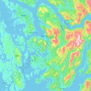
Name: Bergen topographic map, elevation, terrain.
Location: Bergen, Vestland, Norway (60.17609 5.14458 60.53609 5.68679)
Average elevation: 125 m
Minimum elevation: -4 m
Maximum elevation: 971 m
Other topographic maps
Click on a map to view its topography, its elevation and its terrain.