
Thank you for supporting this site ❤️
Make a donation
Make a donation
Troms og Finnmark topographic map
Click on the map to display elevation.
Thank you for supporting this site ❤️
Make a donation
Make a donation
About this map
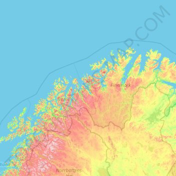
Name: Troms og Finnmark topographic map, elevation, terrain.
Location: Troms og Finnmark, Norway (68.35601 15.59254 71.38488 31.76159)
Average elevation: 196 m
Minimum elevation: -2 m
Maximum elevation: 1,902 m
Thank you for supporting this site ❤️
Make a donation
Make a donation
Other topographic maps
Click on a map to view its topography, its elevation and its terrain.
Thank you for supporting this site ❤️
Make a donation
Make a donation
Thank you for supporting this site ❤️
Make a donation
Make a donation