
Thank you for supporting this site ❤️
Make a donation
Make a donation
Rogaland topographic map
Click on the map to display elevation.
Thank you for supporting this site ❤️
Make a donation
Make a donation
About this map
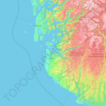
Name: Rogaland topographic map, elevation, terrain.
Location: Rogaland, Norway (58.02785 4.45427 59.84457 7.21467)
Average elevation: 275 m
Minimum elevation: -2 m
Maximum elevation: 1,623 m
Thank you for supporting this site ❤️
Make a donation
Make a donation
Other topographic maps
Click on a map to view its topography, its elevation and its terrain.
Thank you for supporting this site ❤️
Make a donation
Make a donation
Thank you for supporting this site ❤️
Make a donation
Make a donation