
乳源县 topographic map
Interactive map
Click on the map to display elevation.
About this map
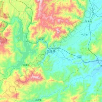
Name: 乳源县 topographic map, elevation, terrain.
Location: 乳源县, 乳源瑶族自治县, 韶关市, 广东省, 中国 (24.61923 113.11085 24.93923 113.43085)
Average elevation: 422 m
Minimum elevation: 53 m
Maximum elevation: 1,416 m
Other topographic maps
Click on a map to view its topography, its elevation and its terrain.