
桂头镇 topographic map
Interactive map
Click on the map to display elevation.
About this map
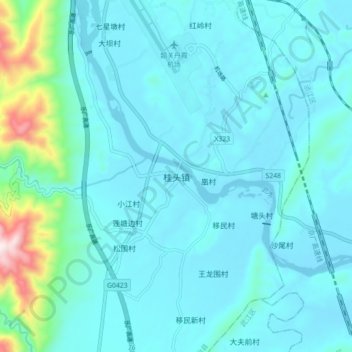
Name: 桂头镇 topographic map, elevation, terrain.
Location: 桂头镇, 乳源瑶族自治县, 韶关市, 广东省, 中国 (24.90593 113.38625 24.98593 113.46625)
Average elevation: 136 m
Minimum elevation: 61 m
Maximum elevation: 684 m
Other topographic maps
Click on a map to view its topography, its elevation and its terrain.