
石坑崆 topographic map
Interactive map
Click on the map to display elevation.
About this map
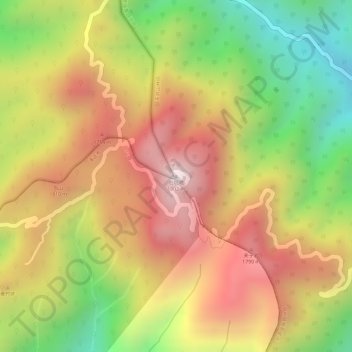
Name: 石坑崆 topographic map, elevation, terrain.
Location: 石坑崆, 天井山林场, 乳源瑶族自治县, 韶关市, 广东省, 中国 (24.92776 112.99086 24.92786 112.99096)
Average elevation: 1,548 m
Minimum elevation: 1,144 m
Maximum elevation: 1,875 m
石坑崆又名莽山峰,猛石坑峰。它座落于广东省阳山县与乳源瑶族自治县交界处,海拔1902米,是广东第一高峰,被誉为“广东屋脊”。这里有广东保存最完好,面积最大的原始森林。那里野生动植物物的种类很多,是广东的天然动植物的宝库,已经成立了八宝山野生动、植物自然保护区,即南岭国家森林公园。
Other topographic maps
Click on a map to view its topography, its elevation and its terrain.