
天井山林场 topographic map
Interactive map
Click on the map to display elevation.
About this map
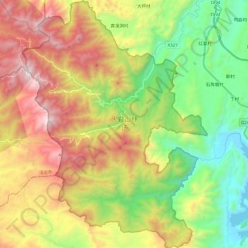
Name: 天井山林场 topographic map, elevation, terrain.
Location: 天井山林场, 乳源瑶族自治县, 韶关市, 广东省, 中国 (24.80339 112.98610 24.97768 113.12942)
Average elevation: 905 m
Minimum elevation: 207 m
Maximum elevation: 1,871 m
Other topographic maps
Click on a map to view its topography, its elevation and its terrain.