
绵阳市 topographic map
Interactive map
Click on the map to display elevation.
About this map
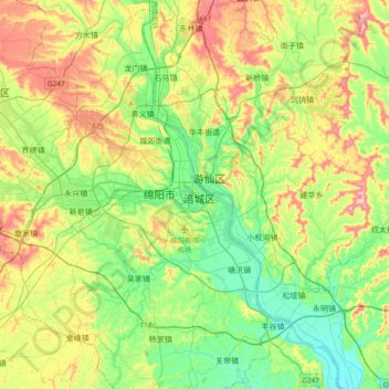
Name: 绵阳市 topographic map, elevation, terrain.
Location: 绵阳市, 涪城区, 绵阳市, 四川省, 621000, 中国 (31.29893 104.59011 31.61893 104.91011)
Average elevation: 507 m
Minimum elevation: 414 m
Maximum elevation: 679 m
Other topographic maps
Click on a map to view its topography, its elevation and its terrain.