
涪城区 topographic map
Interactive map
Click on the map to display elevation.
About this map
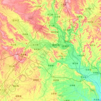
Name: 涪城区 topographic map, elevation, terrain.
Location: 涪城区, 绵阳市, 四川省, 621000, 中国 (31.26991 104.47321 31.61221 104.84376)
Average elevation: 510 m
Minimum elevation: 409 m
Maximum elevation: 642 m
Other topographic maps
Click on a map to view its topography, its elevation and its terrain.