
梓潼县 topographic map
Interactive map
Click on the map to display elevation.
About this map
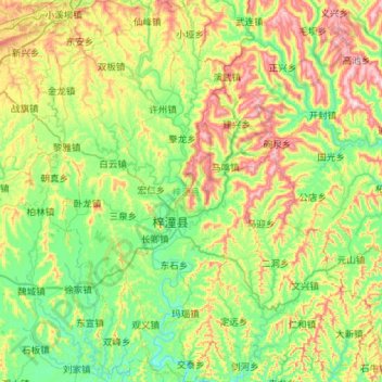
Name: 梓潼县 topographic map, elevation, terrain.
Location: 梓潼县, 绵阳市, 四川省, 中国 (31.43245 104.95598 31.91216 105.45875)
Average elevation: 576 m
Minimum elevation: 420 m
Maximum elevation: 923 m
Other topographic maps
Click on a map to view its topography, its elevation and its terrain.